Title:
191122 Robbers Cave 179 (permalink)
Order Instructions:
To order this photo, send Craig Chandler an email and include the text '191122 Robbers Cave 179'.
Caption:
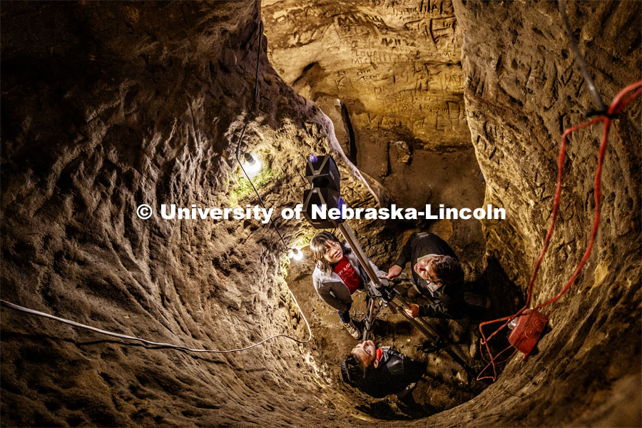
From upper left: Yijun Liao, Professor Ricky Wood and Dylan Downes raise a LIDAR unit to produce a 3-D map of the inside of Robbers Cave and the names etched into the walls. The local sandstone cave has spun legends from use by native Americans, Jesse James and the Underground Railroad to being Lincoln's first brewery. Over the years, thousands of people has etched their names into its walls. Wood is an expert in using LIDAR to map buildings destroyed by natural disasters and was approached by the state historical society to map the cave since the soft sandstone is slowly degrading. LIDAR, which stands for Light Detection and Ranging, is a remote sensing method that uses light in the form of a pulsed laser to measure ranges. Professor Ricky Wood uses LIDAR to digitally map Robbers Cave in Lincoln. November 22, 2019. Photo by Craig Chandler / University Communication.
Copyright:
© 2019, The Board of Regents of the University of Nebraska. All rights reserved.